Skip to content

Get Revising
Join get revising, already a member.

Alberta Wildfire 2016
- Created by: Laybrough29
- Created on: 22-11-20 12:58
- Nicknamed 'the beast'
- Swept along parts of Canada's Alberta province
- Evacuation of 90,000 residents
- Destroyed 2400 homes and buisness'
- No-one was killed or injured as a direct result of the fire
- 600,000ha of land burnt (roughly equivalent to the country of Norfolk)
- The fire could turn out to be canada's most costly disaster
Causes and Contributory Factors
The fire ignited in a remote forested area to the south-west of Fort Mcmurray on 1st of may 2016. The precise cause of the fire remains unknown. Intially the fire was under control, but a shift in the wind direction resulted in a blaze that tore into the outskirts of Fort Mcmurray, the largest settlement in remote Alberta.
Prior to the outbreak, the environmental conditions were extreamly favourable. A lack of winter snowfall and an early snow melt in spring combined with warmer-than-average temperatures that dried out the ground. In late April temperatures sored and, combined with the very low humidity, vegetation in the area became dry.
In the first few days of May, after the fire started, temperatures exceeded 30 degrees and winds increased. The intensity of the fire created its own weather patterns, including lightning, wich led to the ignition of additional fires. This is extreamly rare and led to the intensity and ferocity of the fire.
Scientists linked El Nino to a have a strong effect on the result in the unusually warm and dry early spring conditions. Links to climate change show an apparent increase in fires in recent decades could be a reflection of better reporting, however some scenarios suggest earlier spring in high lattitudes could extend the fire season and thereby increase the wildfire hazard.
What were the impacts?
The evacuation of an entire city caused considerable social and economic impacts.
ENVIRONMENTAL -
- The intensity of the fire severly affected the boreal forest ecosystemdue to the scorched soil and burnt tree roots.
- The dry and scorched peaty soils could reignite at any time until the first heavey rainfall.
- The fire will have released several million tones of co2 into the atmosphere.
- Toxins including mercury,lead and organic compounds released from burning trees and buildings created air pollution…
- Case studies
No comments have yet been made
Similar Geography resources:
Wild fire case study 1.0 / 5 based on 1 rating
Alberta - the impact and human responses as evidenced by a recent wildfire 4.0 / 5 based on 4 ratings
Hazards 6 Wildfires 0.0 / 5
Alberta Wildfire 2.0 / 5 based on 1 rating
20 case study key facts (Paper 1: Physical) 5.0 / 5 based on 1 rating
AQA Physical Geog plans 0.0 / 5
Hazards PPT 0.0 / 5
Hazards 5.0 / 5 based on 1 rating
Geography Carbon Cycle Case Studies 5.0 / 5 based on 2 ratings
Alberta 0.0 / 5
Related discussions on The Student Room
- AQA A Level Geography Paper 1 (7037/1) - 17th May 2023 [Exam Chat] »
- Alevel geography hazard 20 marker »
- How does Canadian grades transfer to the UK? »
- Do I have to use the case studies I was taught for geography? »
- Applying for Politics and/or International Relations? Here are some helpful readings! »
- Double-Ended 'A' Country/City Name Chain »
- Help with application for student finance »
- Bath vs Glasgow »
- Mixed Qualifications »
- University of Strathclyde PGDE accommodation offers 2023/2024 »

Geography Revision
GCSE, AS and A Level Geography Revision
Fires in Nature
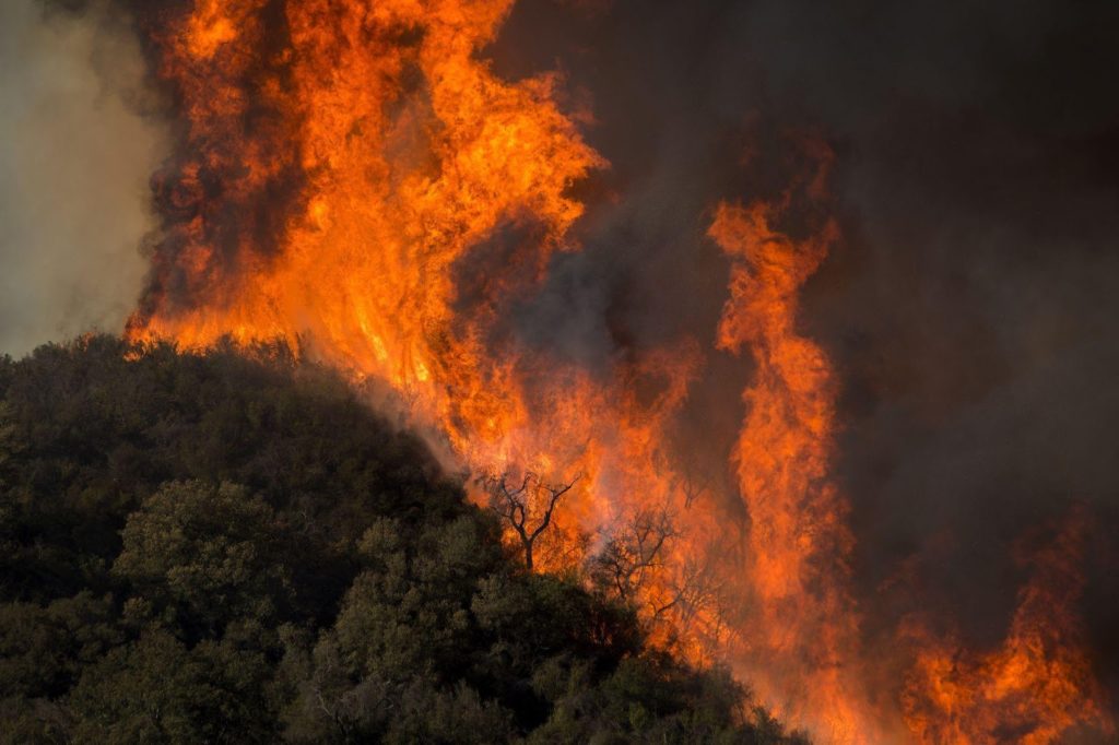
In a matter of moments, a spark or even the sun’s intense rays can ignite raging fires in nature. The wildfire swiftly advances, consuming dense, parched vegetation and virtually everything in its path. The once serene forest transforms into a potential tinderbox, harbouring abundant, untapped fuel. In a rapid surge, the wildfire engulfs thousands of acres of the surrounding terrain, imperilling homes and the lives of those residing nearby.
On average, approximately 5 million acres of land are engulfed by flames each year in the United States, resulting in substantial financial losses. Once ignited, a fire can rapidly race at speeds of up to 14.29 miles per hour (23 kph), leaving destruction in its wake. As it advances through forests and foliage, a fire may develop an independent existence, adapting to sustain itself, even giving rise to smaller blazes by dispersing embers over considerable distances. In this exploration, we delve into the inception of wildfires and their intriguing behaviour.
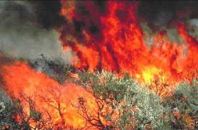
During scorching summer days, when drought conditions peak, even a minor spark from a train’s wheel scraping against the tracks can ignite a ferocious wildfire. Occasionally, fires naturally occur, triggered by solar heat or lightning strikes. However, the majority of wildfires stem from human negligence.
What are the Standard foundations for wildfires and fires in nature?
- Torching
- Campfires
- Disposing of lit cigarettes
- Inappropriately consuming flotsam and jetsam
- Playing with matches or fireworks
- Endorsed fire
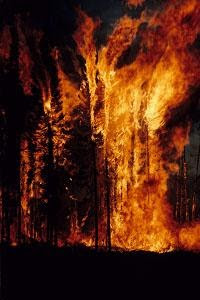
Every substance possesses a threshold temperature at which it will erupt into flames, referred to as its ignition point. Wood, for instance, has an ignition point of 572 degrees Fahrenheit (300°C). Once heated to this temperature, wood releases hydrocarbon gases that combine with oxygen present in the atmosphere, undergo combustion, and give rise to fire.
Three essential components must converge for the process of ignition and combustion to occur. Fire necessitates a source of fuel for burning, a supply of air to provide oxygen, and an external heat source to elevate the fuel to its ignition temperature. These factors—heat, oxygen, and fuel—comprise the essential components of the fire triangle. Firefighters frequently reference the fire triangle as they strive to extinguish a blaze. The underlying concept is that by eliminating any of the triangle’s pillars, they can manage and ultimately quell the fire.
Following the ignition event and the initiation of a fire, several factors come into play to determine the fire’s propagation. These three elements encompass fuel, weather conditions, and terrain characteristics. Depending on the interplay of these factors, a fire can either swiftly diminish or escalate into an intense conflagration, engulfing vast expanses of land.
Fuel Loads
The spread of wildfires hinges on the type and quantity of surrounding fuel. Fuel encompasses a range of materials, from trees and underbrush to dry grasslands and even structures like homes. The volume of combustible matter within a fire is termed the fuel load, gauged by the available fuel per unit area, typically measured in tons per acre.
A modest fuel load will result in a fire that burns and advances slowly, exhibiting low intensity. Conversely, abundant fuel will fuel a more vigorous fire, leading to accelerated spread. As the fire heats the surrounding materials faster, ignition occurs more swiftly. Additionally, the dryness of the fuel profoundly impacts fire behaviour. When fuel is parched, combustion accelerates, engendering a fire that proves notably challenging to contain.
Here are the essential fuel qualities that choose how it influences a fire:
- Size and shape
- Dampness content
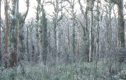
Small fuel components, often referred to as fine fuels, such as dry grass, pine needles, withered leaves, twigs, and other lifeless foliage, undergo combustion more swiftly than large logs or stumps (which is why kindling is used to start a fire instead of logs). On a molecular level, different fuel materials exhibit varying ignition times. However, in the context of a wildfire, where much of the fuel shares the same material composition, the primary determinant of ignition timing is the ratio of the fuel’s total surface area to its volume. As the surface area of a twig is only marginally larger than its volume, it becomes quickly susceptible to ignition. In contrast, a tree’s surface area is significantly smaller than its volume, necessitating more time to absorb heat before igniting.
As the fire progresses, it desiccates the material just beyond its reach, and the heat and smoke approaching potential fuel cause the moisture within it to evaporate. This renders the fuel more conducive to ignition when the advancing fire eventually reaches it. Fuels that are somewhat dispersed also undergo quicker dehydration compared to densely packed fuels, as the dispersed arrangement provides increased oxygen availability. Conversely, more densely packed fuels retain higher levels of moisture, which absorbs and mitigates the fire’s heat.
Climate’s Role in Wildfires
Weather plays a vital role in the initiation, progression, and cessation of wildfires. Drought conditions create exceptionally favourable environments for wildfires, while winds facilitate the rapid spread of fires. Adverse weather conditions can accelerate a fire’s movement and extend its reach. Moreover, these conditions can significantly complicate firefighting efforts. Three key weather elements exert influence on wildfires:
- Temperature
- Dampness
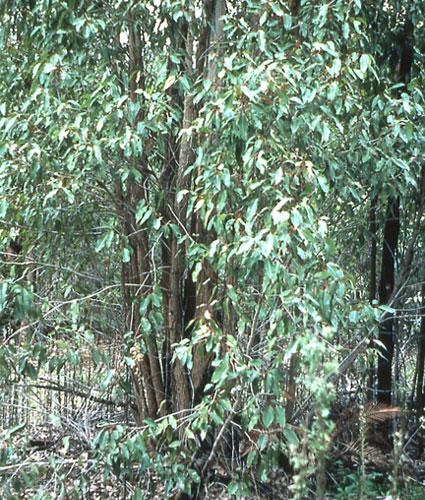
As previously mentioned, temperature wields a significant influence on the ignition of wildfires, being one of the three fundamental components of the fire triangle. Sunlit wooden sticks, trees, and underbrush on the ground absorb radiant heat, warming and desiccating potential fuels. Elevated temperatures facilitate the ignition and faster combustion of fuels, thus contributing to the accelerated spread of wildfires. Consequently, wildfires tend to peak during the afternoon when temperatures are at their zenith.
Undoubtedly, wind exerts the most profound impact on a wildfire’s behaviour, also presenting the most volatile variable. Winds supply additional oxygen to the fire, intensify fuel desiccation, and propel the fire across the landscape at an accelerated pace.
The swifter the wind’s velocity, the more rapid the fire’s propagation. The fire generates its own winds, which can be several times faster than the surrounding breeze. It can even hurl embers into the air, sparking new fires—a phenomenon known as spotting. Wind can also shift the fire’s trajectory and loft it into the trees, culminating in a crown fire.
While wind amplifies fire spread, moisture counters its advance. Humidity and precipitation, as forms of moisture, impede the fire’s progress and diminish its intensity. Fuels with high moisture content are resistant to ignition, as moisture absorbs the fire’s heat. Low humidity levels, indicating minimal water vapour in the air, elevate the likelihood of wildfires. Higher humidity levels, conversely, hinder fuel drying and ignition.
Given moisture’s inhibitory effect on fire ignition, precipitation directly influences fire prevention. Saturated air releases its moisture as rainfall. This rain and other forms of precipitation elevate fuel moisture content, effectively suppressing the potential outbreak of wildfires.
Fire on the Mountain
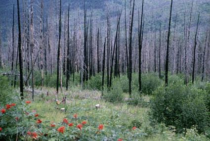
The geographical layout, or terrain, represents a third significant factor influencing wildfire behaviour. Unlike fuel and weather, geography remains unchanged; however, it can either aid or disrupt the progress of a wildfire. Among geographical factors, slope holds the greatest sway in relation to wildfires.
Unlike humans, fires tend to ascend uphill more swiftly than downhill—steeper slopes translate to faster fire movement. Fires follow the prevailing wind, which often blows uphill. Additionally, the fire’s heat and smoke rise in that direction, preheating the fuel higher up the slope. Conversely, once the fire reaches the hill’s summit, its return downhill is challenged since it cannot preheat the descending fuel as effectively.
Beyond the immediate devastation caused by fires, they can also precipitate long-lasting issues whose impact may not be felt for years after the flames are extinguished. When fires obliterate vegetation on a slope or mountain, they can weaken organic material within the soil and hinder water penetration. A consequence of this is heightened vulnerability to severe erosion, potentially leading to debris flows.
An illustrative instance of this occurred after a July 1994 wildfire razed around 2,000 acres of forest and underbrush on the steep slopes of Storm King Mountain near Glenwood Springs, Colorado. Two months later, heavy rainfall triggered debris flows that deposited copious amounts of mud, rocks, and debris onto a 3-mile stretch of Interstate 70, as reported by the United States Geological Survey. These debris flows submerged 30 vehicles and carried two into the Colorado River.
While wildfires are commonly perceived as perilous, many wildfires serve beneficial purposes. Some fires clear underbrush in forests, curbing the potential for more extensive fires that could arise if the buildup of brush were left unchecked. Wildfires can also enhance plant growth by curbing disease transmission, releasing nutrients from burned plants into the soil, and fostering new growth.
How to Engage the Blaze
Picture yourself in an inferno, clad in hefty gear, your lungs choked with smoke. This glimpse begins to offer a glimpse into the experience of battling an unrelenting wildfire. Every day, countless firefighters risk their lives in the struggle against these merciless blazes. Among the elite ground-based firefighting units, two categories stand out:
Hotshots: Operating in 20-member squads, these highly trained firefighters’ primary task is to construct a firebreak around the blaze to contain its spread. A firebreak is an area completely stripped of potential fuel for the fire. The U.S. Forest Service employs Hotshots for this purpose.
Smokejumpers: These firefighters are akin to paratroopers, leaping out of planes to reach remote fire sites. Their mission is to suppress small fires before they escalate into larger ones. Once on the ground, smokejumpers employ the same firefighting techniques as Hotshots. Only a few hundred smokejumpers exist throughout the entire United States, all employed by either the U.S. Forest Service or the Bureau of Land Management (BLM).
In addition to constructing firebreaks and dousing fires with water and fire retardants, ground teams may also employ backfires. Backfires are fires initiated by the ground crew that advance toward the approaching wildfire. The aim of setting a backfire is to preemptively burn any potential fuel in the path of the advancing wildfire.
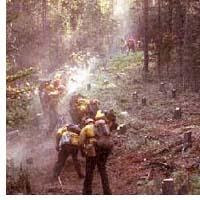
While the Hotshots, Smokejumpers, and other support teams engage in ground battles, they receive substantial assistance from aerial resources. Air tankers are frequently deployed to release thousands of gallons of water and retardant onto fires. The crimson substance often seen dropping from planes and helicopters is a retardant compound containing phosphate fertilizer, which aids in slowing down and cooling the fire.
Helicopters also play a pivotal role in combating fires from above. Equipped with buckets capable of holding several gallons of water, these aircraft hover over the fire and release water bombs. Helicopters are also essential for transporting firefighters to and from the fire zone.
Wildfires are formidable natural forces that can rage as long as they possess fuel, oxygen, and heat. Firefighters’ task is to eliminate one or more components of the fire triangle—fuel, oxygen, or heat—to curtail further damage.
Read more about Climatic Hazards
Frequently Asked Questions
How do wildfires start in nature.
Wildfires can start from natural causes like lightning strikes, as well as human activities such as discarded cigarettes or unattended campfires.
What is the role of fire in natural ecosystems?
Fire plays a vital role in ecosystem renewal by clearing away dead vegetation, promoting new growth, and cycling nutrients back into the soil.
How do wildfires impact air quality and human health?
Wildfires release smoke and particulate matter into the air, contributing to poor air quality and posing health risks for people with respiratory conditions.
How can controlled burns help manage fire hazards?
Controlled burns, or prescribed fires, are intentionally set fires used to reduce fuel buildup, mitigate the risk of large, destructive wildfires, and restore ecosystems.
What are some strategies for preventing and managing wildfires?
Prevention measures include fire-safe building design, creating defensible spaces, and public education. Active firefighting involves strategies like containment lines and aerial water drops.
- Fires in Nature . (n.d.). Retrieved from SmokeyBear: https://smokeybear.com/en/about-wildland-fire/benefits-of-fire/fire-in-nature
- Forest Fires – An overview . (n.d.). Retrieved from BorealForest: http://www.borealforest.org/world/innova/forest_fire.htm
- ForestFires . (n.d.). Retrieved from EnergyEducation: https://energyeducation.ca/encyclopedia/Forest_fire
- How Wildfires work . (n.d.). Retrieved from HowStuffWorks: https://science.howstuffworks.com/nature/natural-disasters/wildfire.htm
- How Wildfires Work . (n.d.). Retrieved from How StuffWorks: https://science.howstuffworks.com/nature/natural-disasters/wildfire1.htm
- How Wildfires Work . (n.d.). Retrieved from HowStuffWorks: https://science.howstuffworks.com/nature/natural-disasters/wildfire2.htm
- How Wildfires Work . (n.d.). Retrieved from HowStuffWorks: https://science.howstuffworks.com/nature/natural-disasters/wildfire3.htm
- How Wildfires Work . (n.d.). Retrieved from HowStuffWorks: https://science.howstuffworks.com/nature/natural-disasters/wildfire4.htm
- The Ecology of Fire . (n.d.). Retrieved from The Nature Education: https://www.nature.com/scitable/knowledge/library/the-ecology-of-fire-
- 13259892/ Wildfires . (n.d.). Retrieved from National Geographic: https://www.nationalgeographic.org/encyclopedia/wildfires/
Cite/Link to This Article
<a href="https://geography-revision.co.uk/a-level/physical/fires-in-nature/">Fires in Nature</a>
"Fires in Nature". Geography Revision . Accessed on May 7, 2024. https://geography-revision.co.uk/a-level/physical/fires-in-nature/.
"Fires in Nature". Geography Revision , https://geography-revision.co.uk/a-level/physical/fires-in-nature/. Accessed 7 May, 2024.
This website works best with JavaScript switched on. Please enable JavaScript
- Centre Services
- Associate Extranet
- All About Maths
A-level Geography
- Specification
- Planning resources
- Teaching resources
- Assessment resources
- Introduction
- Specification at a glance
- 3.1 Physical geography
- 3.2 Human geography
- 3.3 Geography fieldwork investigation
- 3.4 Geographical skills checklist
- Scheme of assessment
- Non-exam assessment administration
- General administration
3.1.5.6 Fires in nature
Nature of wildfires. Conditions favouring intense wild fires: vegetation type, fuel characteristics, climate and recent weather and fire behaviour. Causes of fires: natural and human agency. Impacts: primary/secondary, environmental, social, economic, political. Short and long-term responses; risk management designed to reduce the impacts of the hazard through preparedness, mitigation, prevention and adaptation.
Impact and human responses as evidenced by a recent wild fire event.

welcome to the geography portal!
- 0 Shopping Cart

Geography Case Studies
All of our geography case studies in one place

Coastal Erosion
Use the images below to find out more about each case study.
The Holderness Coast

The Dorset Coast
Happisburgh
Coastal Management
Sandscaping at Bacton, Norfolk
Coastal Realignment Donna Nook
Coastal Realignment Medmerry
Coastal Deposition
Spurn Point
Blakeney Point Spit
Earthquakes
Amatrice Earthquake Case Study
Chile Earthquake 2010
Christchurch Earthquake
Haiti Earthquake
Japan Earthquake 2011
L’Aquila Earthquake
Lombok Indonesia Earthquake 2018
Nepal Earthquake 2015
Sulawesi, Indonesia Earthquake and Tsunami 2018
Taiwan (Hualien) Earthquake 2024
New Zealand 2016
Malaysia Causes of Deforestation
Malaysia Impacts of Deforestation
Alaska Case Study
Epping Forest Case Study
Sahara Desert Case Study
Svalbard Case Study
Thar Desert Case Study
Western Desert Case Study
Energy Resources
Chambamontera Micro-hydro Scheme
Extreme Weather in the UK
Beast from the East Case Study
Storm Ciera Case Study
Food Resources
Almería, Spain: a large-scale agricultural development
The Indus Basin Irrigation System: a large-scale agricultural development
Sustainable food supplies in a LIC – Bangladesh
Sustainable food supplies in a LIC – Makueni, Kenya
Landforms on the River Tees
Landforms on the River Severn
Indus River Basin (CIE)
River Flooding
Jubilee River Flood Management Scheme
Banbury Flood Management Scheme
Boscastle Floods
Kerala Flood 2018
Wainfleet Floods 2019
The Somerset Levels Flood Case Study
UK Floods Case Study November 2019
River Management
The Three Gorges Dam
Mekong River
The Changing Economic World
How can the growth of tourism reduce the development gap? Jamaica Case Study
How can the growth of tourism reduce the development gap? Tunisia Case Study
India Case Study of Development
Nigeria – A NEE
Torr Quarry
Nissan Sunderland
The London Sustainable Industries Park (London SIP)
Tropical Storms
Beast from the East
Hurricane Andrew
Cyclone Eline
Cyclone Idai Case Study
Typhoon Haiyan 2013
Hurricane Irma 2017
Typhoon Jebi 2018
Hurricane Florence 2018
Typhoon Mangkhut 2018
Urban Issues
Birmingham – Edexcel B
Urban Growth in Brazil – Rio de Janeiro
Urban Growth in India – Mumbai
Urban Growth in Nigeria – Lagos
London – A Case Study of a UK City
Inner City Redevelopment – London Docklands
Sustainable Urban Living – Freiburg
Sustainable Urban Living – East Village
Sustainable Urban Transport Bristol Case Study
Bristol – A major UK city
Volcanic Eruptions
Eyjafjallajokull – 2010
Mount Merapi – 2010
Mount Pinatubo – 1991
Sakurajima Case Study
Nyiragongo Case Study
Water Resources
Hitosa, Ethiopia – A local water supply scheme in an LIC
The South-North Water Transfer Project, China
Wakal River Basin Project
Lesotho Large-Scale Water Transfer Scheme
Share this:
- Click to share on Twitter (Opens in new window)
- Click to share on Facebook (Opens in new window)
- Click to share on Pinterest (Opens in new window)
- Click to email a link to a friend (Opens in new window)
- Click to share on WhatsApp (Opens in new window)
- Click to print (Opens in new window)
Please Support Internet Geography
If you've found the resources on this site useful please consider making a secure donation via PayPal to support the development of the site. The site is self-funded and your support is really appreciated.
Search Internet Geography
Top posts and pages.
Latest Blog Entries
Pin It on Pinterest
- Click to share
- Print Friendly
- International
- Schools directory
- Resources Jobs Schools directory News Search
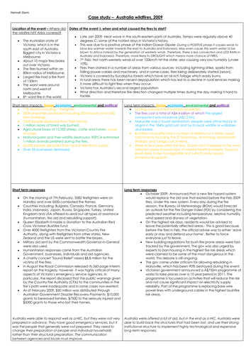
Geography A level Australia wildfire case study poster A3
Subject: Geography
Age range: 16+
Resource type: Assessment and revision
Last updated
9 June 2020
- Share through email
- Share through twitter
- Share through linkedin
- Share through facebook
- Share through pinterest

For the topic on natural hazards
I created this poster and achieved an A* in my Geography A level, including the highest mark nationally for the AQA physical goegraphy paper in 2018.
Message me if you have any questions!
Tes paid licence How can I reuse this?
Your rating is required to reflect your happiness.
It's good to leave some feedback.
Something went wrong, please try again later.
This resource hasn't been reviewed yet
To ensure quality for our reviews, only customers who have purchased this resource can review it
Report this resource to let us know if it violates our terms and conditions. Our customer service team will review your report and will be in touch.
Not quite what you were looking for? Search by keyword to find the right resource:

IMAGES
VIDEO
COMMENTS
CoreLogic identifies and defines wildfire risk in two forms. First, an analysis of fuel and terrain characteristics results in a relative rank that defines wildfire risk categorically. Properties are identified by one of the following risk categories: "Low," "Moderate," "High" or "Very High.". Two additional labels, "Urban ...
Case Study - Black Summer Bushfires, Australia Background. The 2019-20 bushfire season began in September 2019 and ended in March 2020; It was one of most devastating wildfire seasons in Australian history; The fires burned over 20 million hectares of land and it is estimated that over 1 billion animals were killed
Haiti earthquake case study. 118 terms. H31d106. Preview. A-Level Geography - Exam Q (Physical Geography) 35 terms. Dishal15. Preview. AQA GCSE Geography - The Changing Economic World.
Alberta wildfire case study. 1 the spatial and temporal setting of the event The Alberta wildfire started on the first of May 2016 and began at the southwest of Fort McMurray, Alberta, Canada. The wildfire spread across northern Alberta and into Saskatchewan and burnt 589,552 hectares (1,456,810 acres) in total.
Give 5 key primary impacts to do with the California 2018 wildfire. 1. 97 civilians and six firefighters were killed in wildfires. 2. By the 9th of November, 10,321 structures had been destroyed by the fire. 3. 8527 total fires occurred over the duration of the wildfire period. 4.
AQA A-Level Geography - Alberta Wildfire. 36 terms. Gnoblinslap. Preview. Geography A level - energy - Nuclear+Examples. 5 terms. JLC1336. Preview. Hurricane Matthew Impacts in Haiti. ... Geography GCSE OCR B Case Studies- Large scale Antarctic- Antarctic Treaty. Teacher 10 terms. mrsswalters. Preview. 2020 Bushfires Australia. 10 terms ...
Alberta Wildfire 2016. Key Facts. Causes and Contributory Factors. The fire ignited in a remote forested area to the south-west of Fort Mcmurray on 1st of may 2016. The precise cause of the fire remains unknown. Intially the fire was under control, but a shift in the wind direction resulted in a blaze that tore into the outskirts of Fort ...
- Showers of burning debris hit long before the main fire, created smaller fires and used up resources - Fires spread early within the town - Firefighting abandoned after 45mins due to speed and intensity "Save lives, keep evacuation moving" - Evacuation efforts stifled by burnovers, at least 19. Not often a problem but not many fires analysed as much as Camp Fire, may be part of larger trend ...
Case studies all in one Here I have put all the case studies figures into one document because over the two separate notes that I've made for human and physical factors on tectonic hazard I used the same case studies but using different figures. In the exam you can use the same case study more than once as
The geographical layout, or terrain, represents a third significant factor influencing wildfire behaviour. Unlike fuel and weather, geography remains unchanged; however, it can either aid or disrupt the progress of a wildfire. Among geographical factors, slope holds the greatest sway in relation to wildfires. Unlike humans, fires tend to ascend ...
Education and warning systems can provide invaluable information to people in fire prone areas. Lookouts and regular patrols can help with early evacuation. Use of retardants combined with controlled burning can contain a wildfire, provided this is well planned and co-ordinated in advance of the event.
A fully planned lesson that covers the types, causes, effects and responses to wildfires; it also covers the case study of wildfires in South Australia (Black Saturday) High quality worksheets included within the ppt
Wildfires are caused by both natural and human factors, though most are caused by humans. Natural causes include lightning strikes, volcanic eruptions and even the heat from the sun. Human causes include campfires and barbecues getting out of control, cigarettes being discarded when they are still lit, and sparks from machinery or power lines.
- Challenging to respond to as it couldn't be put out - Area was covered in flammable fuel (plants) - Joined with another fire - Fire service was not prepared as the don't deal with lots of fires, especially not on such a large scale - They would need multiple fire engines from multiple counties which is difficult to co-ordinate
Subject: Geography. Age range: 16+. Resource type: Lesson (complete) File previews. pptx, 3.18 MB. 2019/2020 Australia Wildfire Bushfire Case Study A-Level Geography. A 22 slide PowerPoint presentation with relevant 9 mark exam question. Tes paid licence How can I reuse this?
3.1.5.6 Fires in nature. Nature of wildfires. Conditions favouring intense wild fires: vegetation type, fuel characteristics, climate and recent weather and fire behaviour. Causes of fires: natural and human agency. Impacts: primary/secondary, environmental, social, economic, political. Short and long-term responses; risk management designed to ...
The Camp Fire in 2018 was one of the most damaging wildfires in US history and was the most damaging wildfire in California history. Such an event affords a chance to study and learn lessons that can hopefully be applied to similar hazards in the future. Using the Camp Fire as a case study, the research will follow a sort of PAR model format ...
On this page you will find an interactive map with some of the best case studies and examples for A-Level - with fact files, links, further thinking, analysis and much more! ... aqa a-level geography specification. a-level resources by topic. the ultimate guide to a-level geography. a-level exam question & answer bank.
Australian wildfire case study wildfires, australia areas affected causes impacts responses more than million hectares of land were burned. regions across the. ... Some case study summaries for unit 1 as geography; GCSE Geography Paper 1 Climate Change; The holderness coast; Coasts Notes; Threats to Antartica;
Share this: Geography Case Studies - A wide selection of geography case studies to support you with GCSE Geography revision, homework and research.
What were the physical causes of Black Saturday? -10 years of drought. -oil rich forest fuel - e.g. eucalyptus trees. -temperatures of 46 degrees + for 2 months before. -100km/hr winds. -topography - lots of hills. -a change in wind direction - caused fires eastern flanks to become massive fire fronts.
Geography A level Australia wildfire case study poster A3. Subject: Geography. Age range: 16+. Resource type: Assessment and revision. File previews. pdf, 181.8 KB. For the topic on natural hazards. I created this poster and achieved an A* in my Geography A level, including the highest mark nationally for the AQA physical goegraphy paper in ...
Study with Quizlet and memorize flashcards containing terms like Impact of climate change on wildfires, Conditions needed to start a fire, Sources of heat and more. ... AQA A-Level Geography - Wildfires. 32 terms. Gnoblinslap. Preview. GCSE Physical Landscapes. Teacher 16 terms. rgamesby. ... PHYSICAL GEOGRAPHY 4.b - Economic activity case ...